NASA: More accurate maps available of upcoming total solar eclipse
(KFVS) - NASA says they now have more accurate maps available of the upcoming total solar eclipse in August.
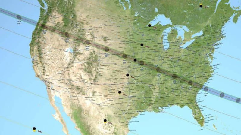
This is thanks to elevation data of the moon from NASA's Lunar Reconnaissance Orbiter, coupled with detailed NASA topography data of Earth.
Watch the tracing of the solar eclipse below or click here.
The total solar eclipse on Monday, Aug. 21 will cross the continental United States beginning in Oregon and ending in South Carolina.
The last time a total solar eclipse spanned the U.S. was in 1918, when the path of totality entered through the southwest corner of Washington and passed over Denver, Colorado; Jackson, Miss.; and Orlando, Fla. before exiting the country at the Atlantic coast of Florida.
Download the KFVS News app: iPhone | Android
Copyright 2017 KFVS. All rights reserved.